
Clerkenwell Road Safe and Healthy Streets Consultation
Results updated 19 Aug 2024
During February and March 2024 we consulted on changes proposed for the Clerkenwell Road area.
Thank you to everyone who took the time to share their views. We had over 700 responses and following the consultation, we have made the decision to implement the proposed changes as a trial.
The new scheme will now be implemented and a notification will go to all local residents and businesses. You can read the decision reports relating to this, and our feedback to the consultation responses in the decision report.
Links:
Overview
We want to transform our streets, so they have more, safe space for everyone to walk and cycle, for children to get to and from school safely, for you to be breathing cleaner air, to reduce carbon emissions from road transport, and for businesses to flourish. We want to ensure that our streets provide a lasting legacy of greener, safer, healthier travel, helping us to deliver our wider Transport Strategy objectives.
Clerkenwell Road is a busy route in the south of the borough used by a high number of people travelling through the area, but is also an important destination home to Hatton Garden, Leather Lane Market, Inns of Courts, residential developments and mixed-use businesses. The road has long been dominated by motor traffic making the area hostile to visit and travel through for most road users.
The Clerkenwell Road corridor has been highlighted as a top cycling priority corridor in Transport for London’s Cycling Action Plan 2, which can be found here, and is one of the busiest walking and cycling routes in the borough. Clerkenwell Road has also been identified in the Camden Transport Strategy (CTS) Delivery Plan, which can be found here, as an area of medium to high priority in terms of addressing road safety, as well as an area deficient in green space. The junctions of Gray’s Inn Road / Theobald’s Road / Clerkenwell Road and Clerkenwell Road / Rosebery Avenue have been highlighted as high priority road safety intervention locations in the CTS Delivery Plan.
Based on the above, Camden Council, in collaboration with Islington Council, are proposing changes to make it safer to walk, cycle and visit the area sustainably, as well as make it more attractive for more people to stop and visit local shops and attractions. The proposed changes would also introduce around 400m of new segregated cycle infrastructure, in both directions, contributing to the Council’s target of 40km of new segregated cycle infrastructure by 2025, as part of our primary cycle network in the Borough.
Over the last 5 years we’ve made many improvements in the area, including walking and cycling changes on Gray’s Inn Road and we have recently consulted on preventing through motor-traffic movements at the Leather Lane junction of Clerkenwell Road to improve safety around the market. We continue to work with Islington Council and local stakeholders on wider improvements to the area, which will be subject to separate consultations.
Why your views matter
Your views matter in helping us shape the Clerkenwell Road corridor in order to help people to walk, wheel, cycle or scoot safely while also improving the attractiveness and biodiversity of the local area, helping reduce and mitigate the impacts of climate change and reducing road danger.
The improvements proposed are suggested to be split into two phases, with Camden Council leading Phase 1, which includes the proposed changes to Clerkenwell Road (this set of proposals), between the junction with Gray’s Inn Road / Theobald’s Road and the junction with Herbal Hill and Saffron Hill. Phase 2 is proposed to be developed by Islington Council and will be consulted on separately.
To view the plans and to find out more about what the proposal would achieve, click on the links in the Related Section at the bottom of this page.
Theobald’s Road/Gray’s Inn Road/Clerkenwell Road/Rosebery Avenue Junction Proposals
- Adding “cycle reservoirs” on Grays Inn Road in both directions (see photo guide for an example of a cycle reservoir and other types of cycling improvement measures). Cycle reservoirs give cyclists the opportunity to access the stop line before vehicles, improving safety for cyclists. To help deliver this in the southbound direction, Mount Pleasant is proposed to be made entry only at the junction with Gray’s Inn Road, and one-way eastbound to the junction with Laystall Street – the rest of Mount Pleasant is proposed to remain two-way.
- Adding a cycle reservoir on Rosebery Avenue to give cyclists the opportunity to access the stop line before vehicles, improving safety for cyclists. To help deliver this, the existing southbound bus lane on Rosebery Avenue would be terminated 17m sooner.
- Adding a separate cycle lane with signals separate from motor vehicles on Theobald’s Road and Clerkenwell Road, in both directions and at both junctions, allowing cyclists to progress separately to motor traffic, improving safety for cyclists.
- Upgrading the junctions of Gray’s Inn Road / Theobald’s Road / Clerkenwell Road and Clerkenwell Road / Rosebery Avenue for pedestrians, by widening some the pavements around the junctions to make pedestrian crossings shorter.
- Introducing a ‘straight across’ crossing across Rosebery Avenue, replacing the existing staggered crossing and pedestrian island to simplify crossing the road for pedestrians.
- Introducing a timed loading bay on Theobald’s Road by Kings Mews, with loading permitted between 10am – 2pm and 10pm – 6am, for the servicing of local shops. This would be done by permanently closing Kings Mews at the junction with Theobalds Road to all motor vehicles.
- Adding a timed loading bay outside 43 Gray’s Inn Road, with loading permitted between 10am – 2pm and 10pm – 6am, for the servicing of local shops.
Pedestrian and Public Realm/Greening Proposals
- We are proposing to close White Bear Yard to all motor vehicles and resurface the existing road with high quality materials, to make the street more inviting to pedestrians.
- Upgrade the existing zebra crossing on Clerkenwell Road by Laystall Street to a parallel crossing, so that pedestrians and people cycling can better access areas such as Leather Lane Market.
- Relocate the existing zebra crossing on Clerkenwell Road by Hatton Garden further west, by Leather Lane and Eyre Street Hill, and upgrade to a parallel crossing, for better access to areas such as Leather Lane Market for pedestrians and cycling.
- Create an improved public space (including seating) by the junction for people to sit rest and socialise, and additional trees to reduce CO2 and provide shade. This is in conjunction with the proposed closure of Leather Lane at the junction with Clerkenwell Road to motor traffic (which was consulted on here),
- Provide additional planting throughout the area with rain gardens and plants to improve biodiversity, provide shade and reduce the risk of flooding, in line with the Borough’s Climate Action Plan.
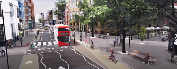
Leather Lane Visualisation
Cycling Proposals
- Add protected (segregated) cycle laneson Clerkenwell Road from the junction with Gray’s Inn Road to the junction with Herbal Hill and Saffron Hill, providing improved safety for people cycling.
- Introduce two new “bus stop bypasses”, one in each direction (designed according to Department for Transport standards), with the westbound bus stop located by Leather Lane, and the eastbound bus stop located by Back Hill to improve safety for cycling, and providing safe pedestrian crossings across the cycle lane for bus users. (See photo guide for an example of a bus stop bypass and other types of cycle measures).
- Add a two-stage right turn for westbound cyclists at the junction with Saffron Hill and Herbal Hill, to allow cyclists to access Cycle Superhighway 6 (CS6) on Herbal Hill safely.
- Relocate and extend the existing dockless bike and e-scooter bay on Clerkenwell Road by the junction with Leather Lane, to the proposed westbound bus stop bypass island to increase pavement space for pedestrians
- Add new cycle stands throughout the area to increase cycle parking availability for visitors to the area.
Bus Proposals
- Relocate the existing eastbound bus stop on Clerkenwell Road by Rosebery Avenue (bus stop Rosebery Avenue Stop CU) to the junction with Back Hill. This would improve access for pedestrians to areas such as Leather Lane Market and Hatton Garden.
- Consolidate the existing westbound bus stops on Clerkenwell Road (Rosebery Avenue Stop CW and Hatton Garden Stop D), to one westbound bus stop by Leather Lane, to provide easier access for bus passengers to Leather Lane Market and nearby attractions, this would also protect bus journey times.
As per Transport for London Guidance, all proposed bus stop locations meet the criteria of a maximum of 400m distance between bus stops. See the Bus Stop Consolidation Plan for current and proposed distances between bus stops.
Additional Parking and Loading Proposals
Introduce a new 30m long 24/7 loading bay on Clerkenwell Road, outside Cavendish Mansions to service shops and homes.
- Close Back Hill to all motor vehicles, at the junction with Clerkenwell Road, for an eastbound bus stop bypass. The existing closure on Back Hill at the junction with Warner Street is proposed to be partially opened to allow vehicles to enter Back Hill from Warner Street.
- Replace the existing paid for parking bay and solo motorcycle bay on Back Hill, near the junction with Clerkenwell Road with a 24/7 loading bay to servicing shops and homes.
- Relocate the timed loading bay and resident permit bay on Back Hill, near the junction with Summers Street to the eastern kerb to give space for vehicles to turn around. The existing restrictions are proposed to remain.
- Remove the existing solo motorcycle bay on Back Hill, by the junction with Warner Street with the adjacent resident permit bay extended further north. This would replace 5m of resident parking relocated from Summers Street.
- Replace an existing paid for parking bay on Warner Street with a resident parking bay to mitigate for the loss of residential parking in other areas of the scheme.
- Replace the existing resident parking bay on Eyre Street Hill, by the junction with Clerkenwell Road with a 24/7 loading bay, for servicing of shops and homes.
- Changes to waiting and loading restrictions on Hatton Garden, to allow loading on double yellow lines by the junction with Clerkenwell Road.
- Remove existing resident permit bay on Saffron Hill, by the junction with Clerkenwell Road and replaced with a new rain garden (see photo guide for an example) to improve biodiversity and reduce the risk of flooding.
A parking, loading and servicing map (and proposed changes for each type of kerbside provision) is provided with more detailed information on proposals for these elements.
To view the plans and find out more about what each proposal would achieve, click on the links in the Related Section at the bottom of this page.
After the consultation a decision report will be produced and published online via our website. Local residents and stakeholders will be notified of the outcome.
Should a decision be made to proceed, we would implement the changes under a permanent Traffic Management Order (TMO).
These proposals if approved would link into our wider project in Holborn - the Holborn Liveable Neighbourhood. That project aims to transform Holborn into a place for people with attractive, healthy, accessible and safe streets for everyone. For more information on the Holborn Liveable Neighbourhood visit: camden.gov.uk/HolbornLN
For information on how we will use data collected from this consultation read our privacy statement: Data protection, privacy and cookies - Camden Council
What happens next
After the consultation, we will carefully consider the responses, alongside other information including relevant data, safety audits and policy contexts, to help us in deciding on whether or not to progress the scheme.
A decision report will be produced and published online via our website. Local residents and stakeholders will be notified of the outcome.
Should a decision be made to proceed, we would implement the changes under a permanent Traffic Management Order (TMO).
Areas
- Holborn and Covent Garden
Audiences
- Anyone from any background
Interests
- Transport and streets
Share
Share on Twitter Share on Facebook